Project Details
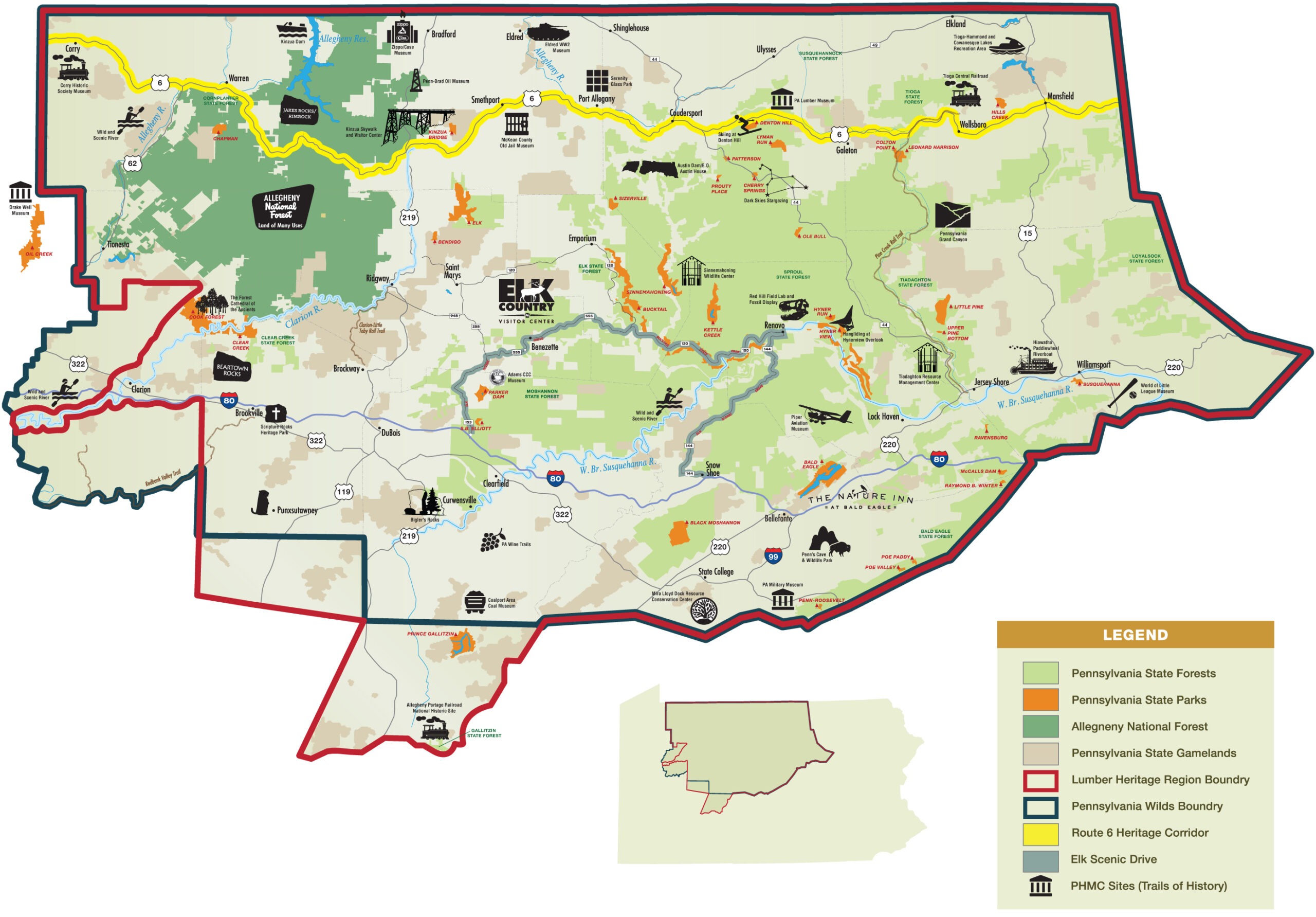
The Pennsylvania Lumber Museum, located in Galeton, Potter County, undertook a project to create a new, large-format wayfinding map to be displayed in the visitor center lobby. This map aims to help visitors navigate the extensive Lumber Heritage Region and Pennsylvania Wilds, which encompass nearly a quarter of Pennsylvania’s total land area. The project’s goal was to make it easier for visitors to discover and explore the numerous attractions and points of interest throughout the region.
The museum staff and volunteers collaborated with the Lumber Heritage Region, PA Wilds, and PA DCNR personnel to compile an up-to-date list of attractions to be featured on the map. These attractions were then depicted on a base graphical layout provided to the exhibit designer, Graphics & Design of State College, PA. The resulting map is big, bright, and visually appealing, designed to draw the attention of museum visitors.
Displayed prominently in the visitor center lobby, the map provides a valuable resource for guests, helping them plan their visits to various sites within the region. Knowledgeable staff at the museum front desk are available to answer questions and offer tips and advice on where to go, what to see, and how long it will take to get there. This project supports the museum’s mission to educate visitors about the region’s natural and cultural heritage and encourages exploration beyond the museum itself.
The new wayfinding map enhances the visitor experience by providing clear and accessible information, promoting further exploration of the Lumber Heritage Region and Pennsylvania Wilds. It serves as an essential tool for engaging visitors and helping them make the most of their time in the area.


